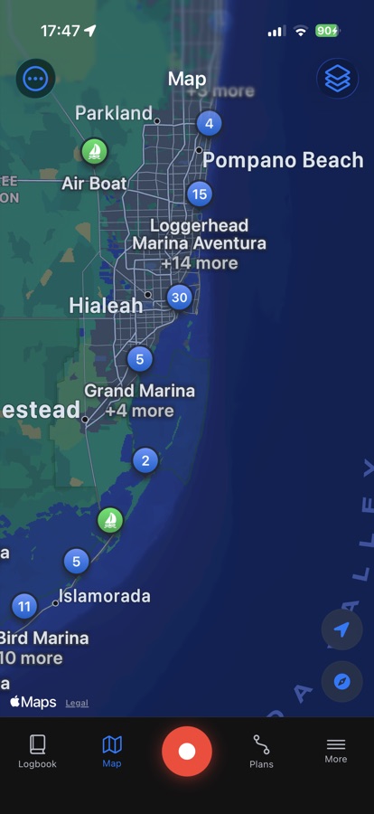
What it is
The chart layer overlays OpenSeaMap seamarks, buoys, beacons, and other navigation marks, plus modeled depth shading, on top of Apple Maps, so you get a genuinely nautical view instead of a road map with water painted blue.
Marina pins cluster as you zoom out and split apart as you zoom in, so a busy stretch of coast stays readable instead of turning into a wall of icons.
How to use it
Open the Map tab and pan or zoom like you would in any maps app. Tap a seamark to identify what it is; tap a marina pin to see what's clustered there and drill into a specific one.
Before you lose signal offshore or head somewhere with patchy coverage, open the areas you plan to sail while you still have a connection. The chart tiles you view get cached on the phone, so the chart keeps working once you're out of range.