59°26′N · 24°45′E

Log every sail.
Read every forecast.

The private logbook for your boat: GPS tracks on nautical charts, a three-day wind and wave forecast, an anchor alarm that actually wakes you, and trip cards worth sharing.

Download on the App StoreFree · for iPhone & iPad · iOS 17+
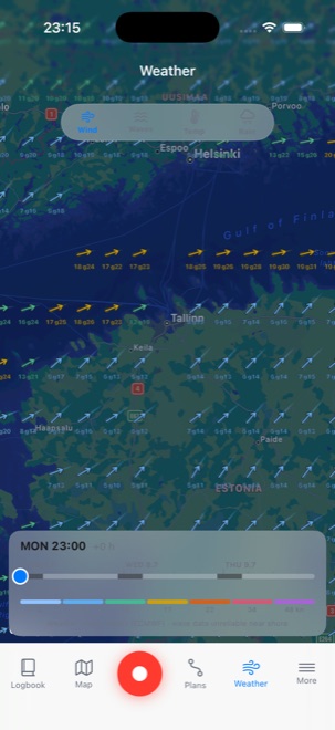
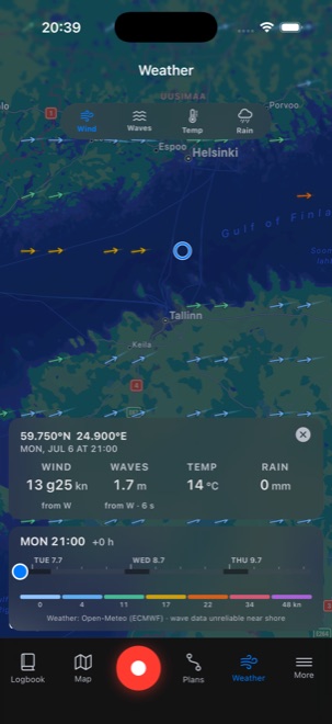
Three-day wind forecast on the nautical chart
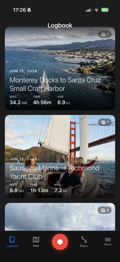
Logbook feed with an aerial trip card and a Golden Gate sailing photo
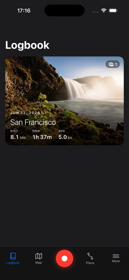
A single logbook trip card with a waterfall photo and distance, time, and average speed

Logbook

Every sail, in one feed.

Every trip you record lands in the Logbook: a photo-led feed of where you went, how far, and how fast.

Show more
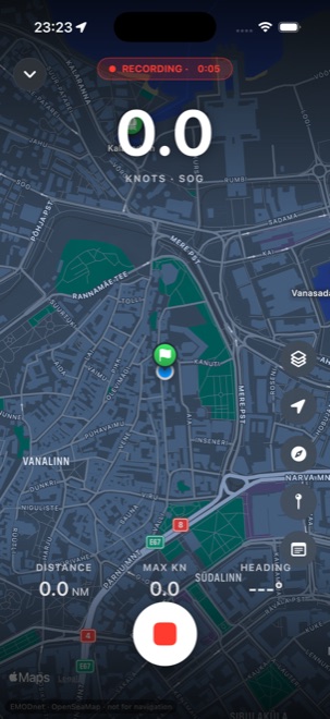
Live GPS recording on the nautical chart with speed, distance, max speed, and heading

Record a sail

One tap, and you're logging.

One tap starts a track. The GPS keeps logging with the phone locked, and you can minimize the view without stopping it.

Show more
Three-day wind forecast map with a time slider
Tapping a point on the weather map for its exact forecast

Weather forecastNew

Three days of weather, on the chart.

A dedicated weather map: three days of wind, gusts, waves, temperature, and rain from the ECMWF model, with a time slider and a tap for the exact numbers anywhere.

Show more
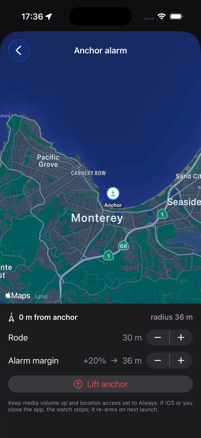
Anchor alarm setup screen with rode length, alarm margin, and a lift anchor button over a chart of Monterey
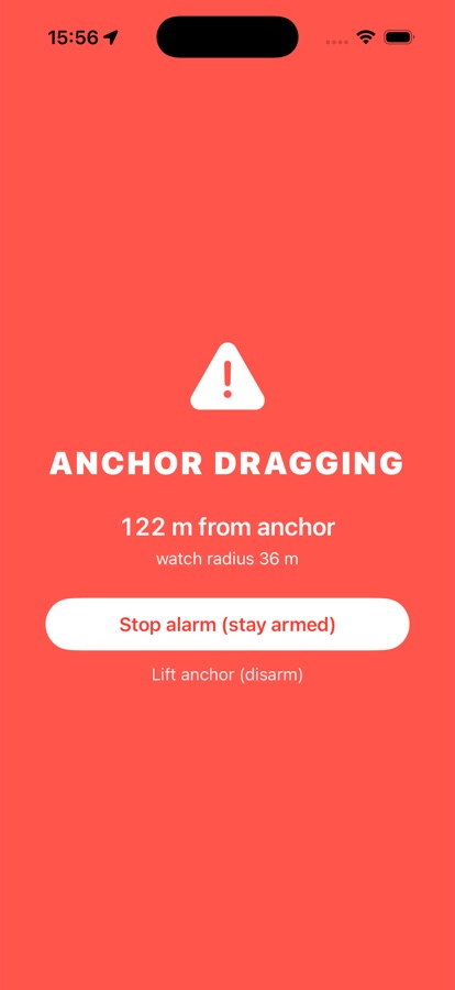
Full-screen anchor dragging alert showing distance from the anchor and a stop alarm button

Anchor alarm

Sleep. It watches the anchor.

Pin your anchor, set rode and margin, and sleep. If the boat drags, a siren, notifications, and a full-screen alert make sure you know.

Show more
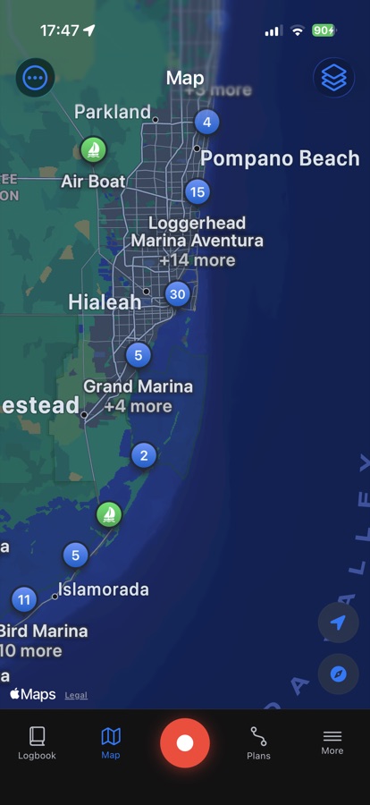
Chart view with clustered marina pins along a coastline

Nautical charts

A real chart, not a road map.

OpenSeaMap seamarks and modeled depths over Apple Maps, with offline tile caching for the areas you sail.

Show more
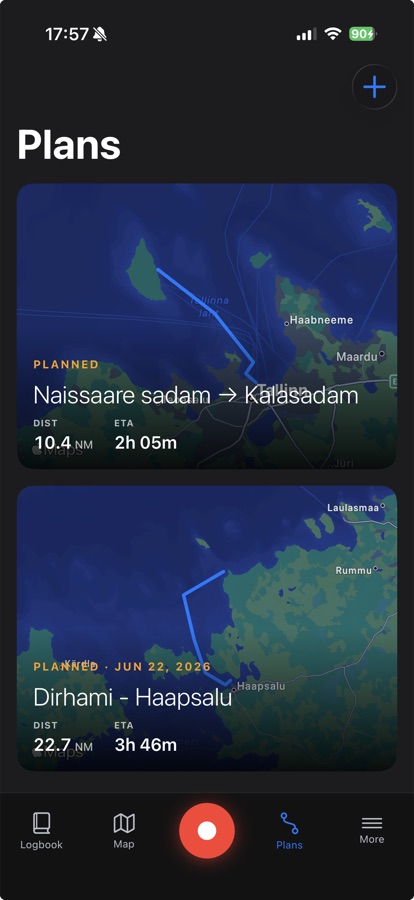
Plans list with two routes drawn on the chart, each showing distance and ETA

Plan a sail

Draw the passage first.

Tap a route on the chart, see distance and ETA, schedule it with your crew, then start it for live course-to-steer guidance.

Show more
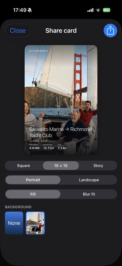
Share card editor with a sailing photo under the Golden Gate Bridge, route stats overlaid, and format pickers

Share cards

Trips worth posting.

Strava-style trip cards from your photos or your videos, with the route, stats, and crew overlaid. Square, postcard, or story format.

Show more
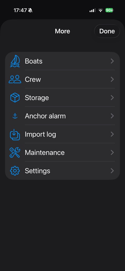
More menu listing Boats, Crew, Storage, Anchor alarm, Import log, Maintenance, and Settings
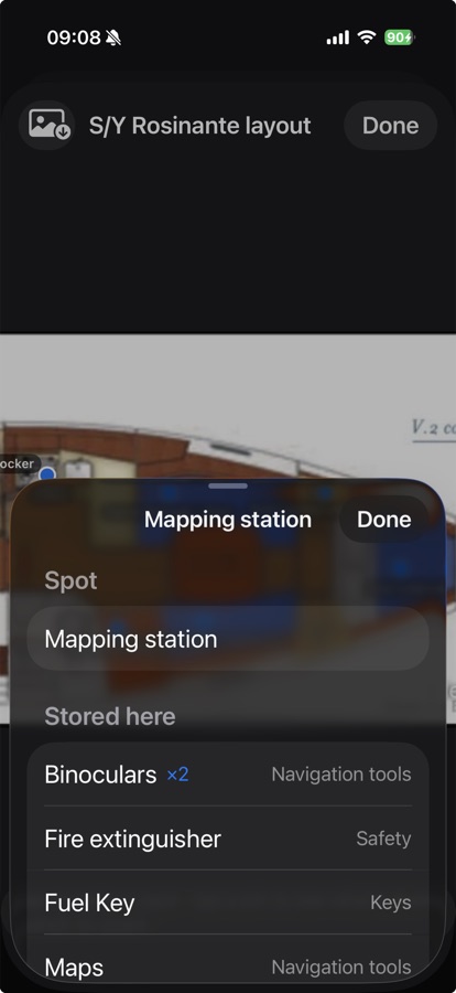
Boat storage layout showing a stored-item list for a mapping station spot

The whole boat

The rest of the boat, handled.

Boats, crew, maintenance with engine hours, GPX import, and onboard storage mapped on your boat's own layout, so everyone finds the spare impeller.

Show more

Private by design

No accounts, no analytics, no servers. Everything lives on your device, synced privately between your own devices with iCloud, and exportable as GPX whenever you like. Your data decides when it comes and goes, not us. Read the privacy policy.