What it is
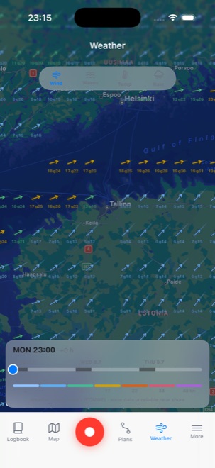
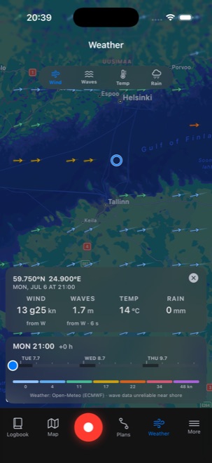
The Weather tab lays a three-day forecast straight over the chart: wind arrows with speed and gusts, wave height, temperature, or rain, depending on which layer you pick.
The forecast comes from the ECMWF model, the same one behind most marine weather services, and it's tuned for the water: wind and waves where you'll actually be sailing, not the nearest city.
How to use it
Pick a layer (wind, waves, temperature, or rain) from the row of buttons, then drag the time slider along the bottom to step through the next three days, hour by hour.
Tap anywhere on the map for the exact forecast at that spot: wind speed and gusts, wave height and period, temperature, and rain, all for the time you've selected on the slider. Any planned trips you've drawn show up on the same map, so you can see the wind lined up against your route before you commit to it. The same forecast is one tap away from the planning view too, so you can check conditions while you're still drawing the route.
Where the data comes from
Wind, gusts, temperature, and rain come from the ECMWF model, run by the European Centre for Medium-Range Weather Forecasts, the same global model that sits behind many national marine forecasts. Waves come from a blended marine model that keeps better detail close to shore than the coarse global wave grid does. All of it is delivered through Open-Meteo's open-data weather API, so there is no account to make and nothing to pay.
The forecast runs three days ahead in one-hour steps and refreshes through the day as new model runs arrive. When you tap a spot, the app pulls a fresh forecast for that exact coordinate rather than reading the nearest arrow, and you choose the units it shows: knots, m/s, km/h, or Beaufort for wind, Celsius or Fahrenheit for temperature, meters or feet for waves, and mm or inches for rain.
Treat it as planning guidance, not a replacement for an official forecast. Near-shore wave data in particular is approximate, and no model replaces checking the official warnings and the sky before you leave the dock.